
Río Celeste from Tamarindo: Guanacaste Drive Guide
Tamarindo to Río Celeste is 155 km and 3-3.5 hours via Huacas, Liberia and Bijagua. Route legs, drive times from each beach, and why to stay overnight.
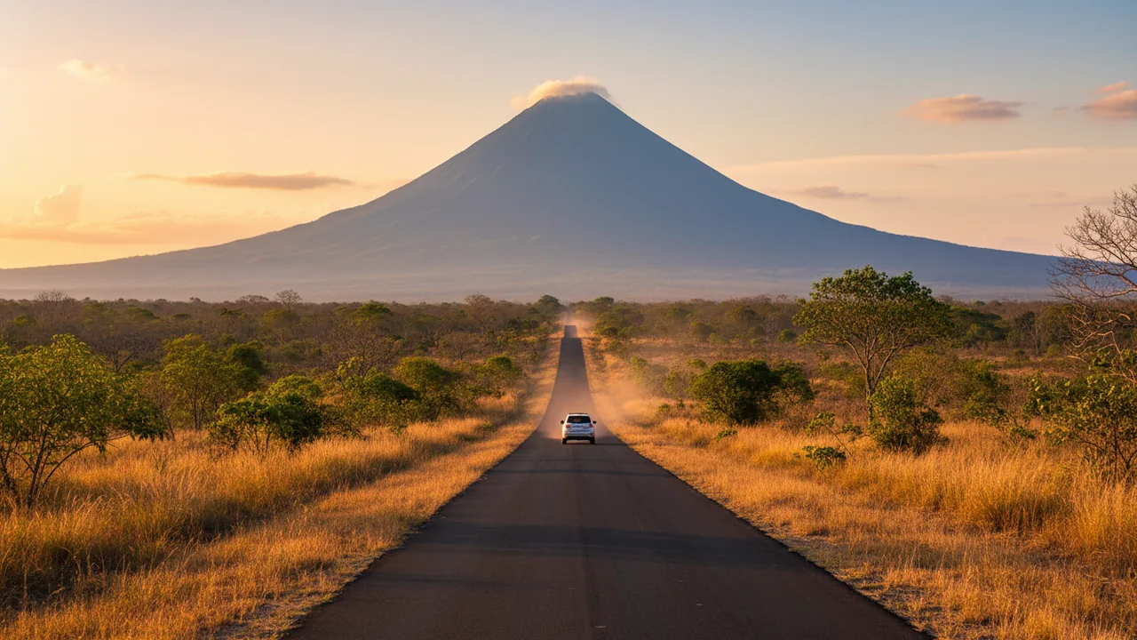
Tamarindo is a good base for Río Celeste, and a slightly awkward one. The drive is about 155 kilometers, mostly highway, and takes three to three and a half hours each way. That is too long for a relaxed day trip and perfectly reasonable as an overnight. The reward is that you cross from Guanacaste’s dry, golden savanna into a soaking wet cloud forest in a single morning — two completely different Costa Ricas in one tank of gas.
Below is the route from Tamarindo and the other Guanacaste beaches, the honest math on day-tripping, and how to structure the day so the driving does not eat the experience.
Distances and drive times from Guanacaste
- Tamarindo: about 155 km (96 miles), 3 to 3.5 hours
- Playa Grande: similar, add 15 minutes for the dirt road out to the highway
- Playa Flamingo / Potrero: about 130 km (81 miles), 2 hours 45 minutes to 3 hours
- Playa Conchal / Brasilito: about 140 km, 3 hours
- Santa Cruz: about 120 km, 2 hours 45 minutes
- Liberia: about 85 km, 1 hour 45 minutes
Add 30 to 45 minutes in the green season. The bottleneck is never the highway; it is the two-lane mountain road after Bijagua, where a slow truck or a rain squall changes everything.
The route from Tamarindo
Leg 1 — Tamarindo to Huacas to Liberia (about 78 km, 1 hour 20 minutes)
Leave Tamarindo on the paved road east, pass through Huacas, and join Route 21 north through Belén toward Liberia. This is flat, fast, and dull in the best way: cattle ranches, mango trees, and the dry hills of Guanacaste. You will pass the turnoff for Playa Grande and the road to Santa Cruz along the way.
Fuel up in Huacas or Liberia. There is a long stretch with nothing but pasture after this, and you do not want to be hunting for a station at 7 a.m. with a 2 p.m. park deadline.
Leg 2 — Liberia to Bagaces and Bijagua (about 70 km, 1 hour 15 minutes)
In Liberia, follow Route 1 east toward Bagaces. From Bagaces, head north and pick up Route 6 toward Bijagua and Upala. The climb begins about 20 minutes out of Bagaces: the grass turns green, the trees get taller, and clouds start sitting on the ridgeline.
Alternative: instead of Liberia, you can cut inland at Santa Cruz through Filadelfia and join Route 1 near Bagaces. The distance is about the same, but you skip Liberia’s traffic and the airport corridor. Local shuttle drivers use it, and so do we when we are moving between the coast and the volcano.
Leg 3 — Bijagua to the El Pilón entrance (8 km, 15 to 20 minutes)
In Bijagua, follow the national park signs. The road narrows, crosses two small bridges, and climbs to the ranger station. Parking is cash only. Navigate to “Parque Nacional Volcán Tenorio” rather than “Río Celeste”, which can send you to a hotel or tubing base nearby.
Should you day-trip from Tamarindo?
Seven hours of driving for three hours in the park is a poor trade unless you love the road. But it can work if you commit to an early start:
- 05:30 — leave Tamarindo
- 07:15 — breakfast in Liberia or Bagaces
- 08:30 — arrive in Bijagua, coffee stop
- 09:00 — enter the park, hike to the waterfall, the Blue Lagoon, and Los Teñideros
- 12:00 — back at the entrance
- 13:00 — tubing or lunch in Bijagua
- 15:00 — drive back
- 18:30 — Tamarindo, just before dark
That is a full, satisfying day — but only if nothing goes wrong. One late start, one accident on Route 21, or one heavy afternoon storm and you are driving mountain roads at night. If you can, spend one night in Bijagua. Rates are lower than on the coast, and you get the park at opening time, when the water is calmest and the light is best.
The overnight version, which is better
Drive up in the afternoon, sleep in Bijagua or along the Río Celeste corridor, and be at the gate at 8:00 a.m. You will walk the trail with a fraction of the people, see the blue at its clearest before the day’s rain stirs the sediment, and still have the whole afternoon for a second activity. Then drive back to the beach in the evening or the next morning.
Bijagua has guesthouses, small lodges, and a handful of sodas. The Río Celeste corridor toward Guatuso has more cabins and is where most tubing and adventure operators are based, including ours.
Where the blue water comes from
Río Celeste is not dyed and it is not a reflection. Two rivers meet at a spot called Los Teñideros: one carries dissolved calcium carbonate and sulfur from the Tenorio volcano, the other arrives clear. When they combine, microscopic particles of calcium sulfate scatter sunlight in a way that turns the water an impossible, milky turquoise. The effect is strongest after dry, settled weather and weakest after heavy rain, when the river runs brown for a day or two. If it poured the night before your visit, ask locally before driving up.
The full trail is about 6.5 km round trip and takes roughly three hours, including the descent of some 250 steps to the waterfall platform. Our Tenorio volcano hike guide covers the trail stop by stop.
What to do with the rest of the day
You are already in the rainforest, so use it. The two-hour Río Celeste tubing tour floats a section of the blue river with a certified bilingual guide, life jackets, and all gear — a completely different way to see the same water. If you want the hike and the river in one booking, the Hiking + Tubing + Lunch package adds the park trail and a traditional lunch for one price.
Traveling with kids or with people who would rather not hike? The sloth and wildlife tour is a gentle hour on flat trails with a guide who finds animals you would walk past, and the coffee and chocolate tour is the best rainy-afternoon backup in the area.
Driving notes for Guanacaste roads
- Speed limits drop to 40 km/h through every town, and radar traps are common on Route 21
- Livestock crosses the road without warning in the early morning
- Fill the tank before leaving the coast; stations between Bagaces and Bijagua are scarce
- In September and October, expect afternoon downpours and reduced visibility on the mountain road
- Do not leave luggage visible in a parked car at trailheads or in town
Frequently asked questions
How long is the drive from Tamarindo to Río Celeste?
About three to three and a half hours for 155 km, going through Huacas, Liberia, and Bagaces. In the green season, plan on closer to four hours.
Can I do Río Celeste as a day trip from Tamarindo?
Yes, if you leave by 5:30 a.m. and keep the visit to the main trail. It is a long day. One night in Bijagua turns it into a much better trip.
Is the road paved all the way?
Yes. Route 21, Route 1, and Route 6 are all paved, and so is the road from Bijagua to the park entrance.
Do I need a 4×4 from Tamarindo?
No in the dry season. In the rainiest months a higher-clearance vehicle is more comfortable on the last stretch and in the parking area.
What time should I arrive at the park?
Between 8:00 and 10:00 a.m. Entry closes at 2:00 p.m., the park closes at 4:00 p.m., and tickets must be bought online in advance through SINAC.
Make the drive worth it
Three hours each way is a real commitment, so do not show up without a plan. Reserve your spot before you leave the beach: browse every Río Celeste tour and park ticket, pick your time, and spend the day in the water instead of in a queue.
Keep reading

What to Bring to Rio Celeste: Complete Packing List
Trail shoes with grip, a rain shell, a refillable bottle and insect repellent. The Rio Celeste packing list we give gues…
Tenorio Volcano Park Tickets & Hours 2026 (Río Celeste)
Tenorio Volcano National Park in 2026: US$13.56 adult entry, online-only tickets, 8 a.m. to 2 p.m. entry, 4 p.m. close.…

Río Celeste with Kids: What Works and What to Skip
Stairs, mud and no swimming inside the park: what Río Celeste is really like with children, which tour fits each age, an…